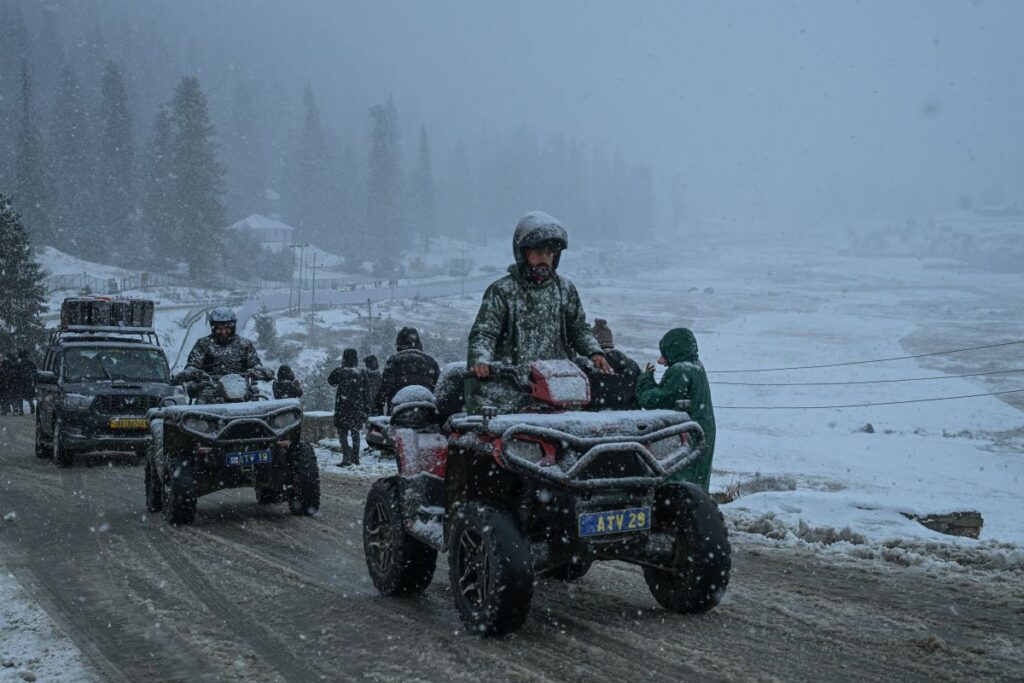
Srinagar- The higher reaches of the Kashmir Valley received fresh snowfall on Friday, while minimum temperatures across Jammu and Kashmir and Ladakh recorded a rise compared to the previous day, officials said.
Officials said that fresh snowfall was reported from higher altitude areas including Gulmarg, Sonamarg, and parts of north Kashmir such as Gurez Valley and Razdan Top. Snowfall was also reported from several other elevated areas across the Valley.
An independent forecaster said snowfall was very likely over the higher reaches of Kupwara and Bandipora, including Razdan Top, Gurez and Tulail Valley, as well as Ganderbal areas such as Sonamarg and its surroundings and the Sonamarg–Drass axis. Snowfall was also expected in Anantnag areas including Pahalgam, Chandanwari, and Aru Valley.
The forecaster added that light snowfall was possible at Gulmarg and along the Pir Panjal range, including the Mughal Road, Sinthan Top, and Margan Top. At the time of filing this report, snowfall was continuing in many of these areas.
Following the snowfall, minimum temperatures showed a slight rise across most parts of the region. In the Kashmir Valley, Srinagar recorded a minimum temperature of minus 1.5 degrees Celsius on Friday, up from minus 3.9 degrees Celsius a day earlier. Qazigund recorded minus 1.6 degrees Celsius compared to minus 4.7 degrees, while Pahalgam registered minus 2.6 degrees against minus 5.0 degrees on Thursday. Kupwara recorded a minimum of minus 1.4 degrees, improving from minus 4.9 degrees.
South Kashmir stations also reported higher night temperatures. Anantnag recorded minus 2.8 degrees Celsius compared to minus 5.7 degrees the previous day, while Pulwama and Shopian recorded minus 4.6 degrees and minus 3.9 degrees respectively, up from minus 6.1 degrees each. Kokernag recorded 0.2 degrees Celsius, compared to minus 1.1 degrees a day earlier.
In north and central Kashmir, Baramulla recorded 0.4 degrees Celsius against minus 2.2 degrees, Bandipora minus 0.7 degrees against minus 2.7 degrees, and Ganderbal 0.1 degrees compared to minus 2.6 degrees. Srinagar airport recorded a minimum of minus 2.8 degrees Celsius, up from minus 5.0 degrees. Gulmarg recorded minus 2.3 degrees, slightly higher than the previous day’s minus 3.2 degrees.
In the Jammu region, Jammu city recorded a minimum of 4.7 degrees Celsius, marginally higher than Thursday’s 4.4 degrees. Banihal recorded 2.9 degrees against 1.9 degrees, Batote 7.7 degrees against 4.9 degrees, and Katra 8.8 degrees compared to 6.8 degrees a day earlier. Bhaderwah and Udhampur recorded 2.0 degrees and 3.0 degrees respectively, rising from sub-zero readings on Thursday.
Ladakh remained colder, though temperatures there also showed a marginal increase. Leh recorded a minimum of minus 8.8 degrees Celsius, Hanle minus 11.2 degrees, Kargil minus 8.3 degrees, and Nubra Valley minus 7.1 degrees.
According to the weatherman, no major weather activity is expected till January 21, though light snowfall is likely at scattered places on January 19 and 20. From January 22 to 24, there is a possibility of light to moderate rain or snow at most places, while some districts of the Chenab Valley, Pir Panjal range, and south Kashmir may receive heavier precipitation.
An advisory has been issued warning of possible heavy rain or snow in parts of the Chenab Valley, Pir Panjal range, and south Kashmir, along with the risk of landslides at vulnerable locations. Farmers have been advised to suspend farm operations during this period, the advisory said.